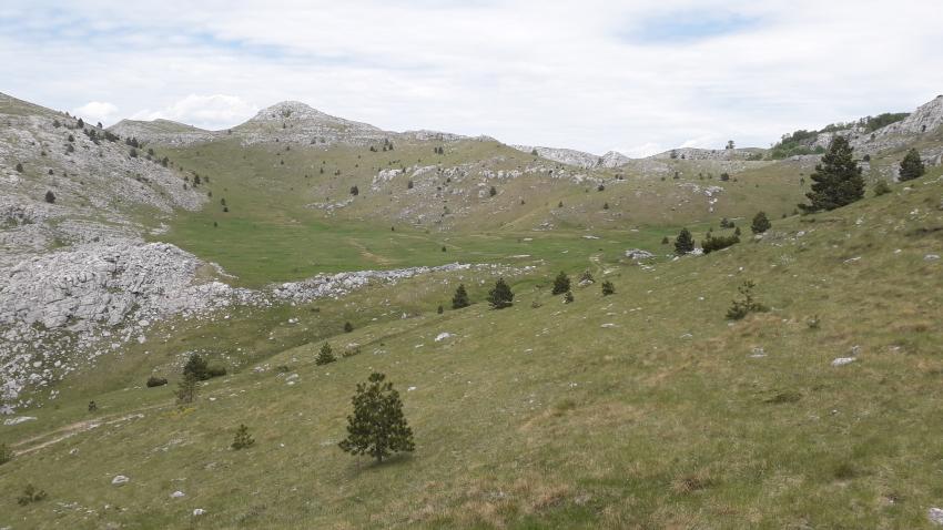
Harsh environmental conditions and inaccessible terrain on the one hand, and climate favourable for the growth of high-quality pastures in the summer, have contributed to keeping Dinara preserved from intense anthropogenic influence, yet largely shaped by long-term livestock farming, the traditional activity of the inhabitants of this region. For cattle-breeders, Dinara plays an integral role, it is a factor of integration: meeting place, social and dynamic nomadic space of livestock movements of Vlachs or Morlachs.
A specific method of seasonal livestock farming, in which during the summer cattle-breeders drive the cattle to the “plateau” in the higher parts of the mountains and remain there until the autumn and the first snow, caused the creation of distinctive values specific for this region. In addition to the ethnological and architectural heritage, autochthonous breeds adapted to harsh environmental conditions, valuable anthropogenically shaped, subnatural habitats, primarily pre-mountain and mountain grasslands have also been created here. Furthermore, in Dinara's peak area, one can also find mountain grasslands created due to the suppression of dwarf mountain pine and mountain forests, which, despite the gradual abandonment of extensive livestock farming on Dinara, still cover large areas, because owing to environmental conditions the successional growth is relatively slow.
History

The Illyrians considered Dinara a sacred mountain called Troura or Triget, and today's name is probably derived from the Illyrian tribe Dindari, who lived on its eastern slopes and used it as a tribal cattle-breeding mountain.
In ancient times, the mountain was called Adrian Horos (in Greek: “the border of the Adriatic”) or Mons Ardio (from Latin arduum: slope; ardour: heat, scorching heat). The highest peak of the Dinaric massif, Troglav, is located in neighbouring Bosnia and Herzegovina, and was named after the Slavic deity, the trinitarian God Troglav, uniting the Java (objective reality, material world), Nava (invisible afterlife) and Prava (laws according to which a good man lives). The Celts worshiped the same god.
The first Croatian state was founded in the protective embrace of Dinara’s slopes. The birthplace of the Croatian state, from the first dukes in the 9th century until the death of the last king of the People’s Dynasty in 1093, was bounded by the rivers Cetina and Zrmanja. Knin, Biskupija and Cetina are located in Dinara’s foothills, and provided Croatian archaeology with an immeasurably valuable archeological treasure, a stone memory without which it would not be possible to imagine the Croatian medieval period today. Knin was the capital of Croatian medieval rulers, while Biskupija was the seat of the Croatian bishop with the right to hold Old Church Slavic religious services from 1040 until its abolition in 1493, with early Romanesque Old Croatian churches. The settlement of Cetina can also be found below Dinara’s slopes, with the church of the Holy Salvation from the 9th century. All this space from Zrmanja to Cetina and all these locations are the foundation stones of Croatian national identity and are crucial for its Roman Catholic Western orientation.
Significant archaeological treasure of past civilizations, as well as numerous traces of Croatia's original lost homeland, were found on the riverbed of the Cetina River and along its banks. Research has been conducted in this area since the 18th century, and some 800 archaeological sites are located besides the river and in its immediate vicinity. The sites date back to the Neolithic, 9000 years ago (traces of settlements upstream from the Trilj Bridge), the Bronze age, 4000 years ago (Bitelić, Radošić, Rumin, Vedrine), Neolithic (Okruglo locality in Radošić, where stone objects and tools were found), prehistoric towns (such as those in the Kosorska glavica settlement or in the stilt-house settlement Dragiš in Otok), traces from the Illyrian times ( such as the Prizid ramparts on Gardun, near Trilj and traces on the Gacko-Kulina site near Gale in the Sinj fields), remnants from Roman times (such as traces of the Roman Silver Road, the city of Roman veterans called Colonia Claudia Aequum in Čitluk near Sinj or the camp of the glorious VII Roman legions near Trilj), and the early Christian pre-Croatian age (such as the remains of an old Christian basilica from the 6th /7th centuries and one of the most famous Old Croatian churches – the Holy Salvation near the source of the Cetina River from the 9th century – a church older than the Croatian coronation basilica of the Blessed Virgin Mary and St Stephen, the resting place of Croatian kings on the island of Jadro dating to the 10th century).
In ancient times, the mountain was called Adrian Horos (in Greek: “the border of the Adriatic”) or Mons Ardio (from Latin arduum: slope; ardour: heat, scorching heat). The highest peak of the Dinaric massif, Troglav, is located in neighbouring Bosnia and Herzegovina, and was named after the Slavic deity, the trinitarian God Troglav, uniting the Java (objective reality, material world), Nava (invisible afterlife) and Prava (laws according to which a good man lives). The Celts worshiped the same god.